Search the NCEM archive
Item details
Maps : Maps of York
Item type: MapsArchive reference: YMP/P
Date/year: 1984 and 1988
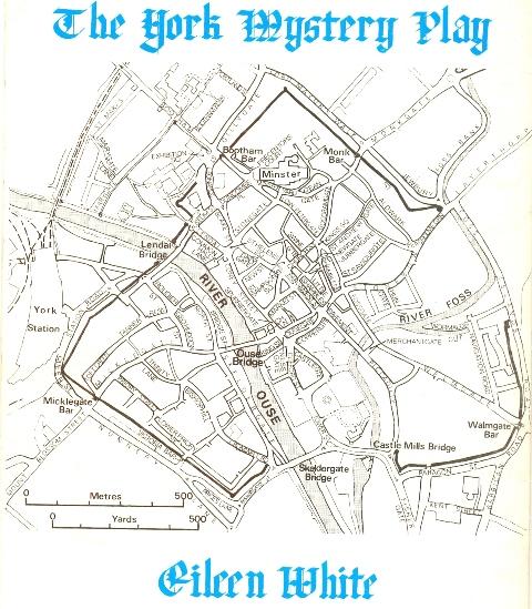
Description: The NCEM does not collect maps, although the archive has a category YMP/P for maps. Below is a map of York from the publication in 1984 by Eileen White about the Mystery Plays (YMP/K/4). The wagons pulled by Guild members started outside the gate of Holy Trinity priory in Micklegate and ended after a circuitous, day-long route, in Pavement, the other side of the river Ouse.

See the entry YMP/P/1 for John Speed's famous map of Yorkshire, which incorporates the first known street map of York (1610). It was one of a series of county maps by Speed. The next known street map of York is in the British library and has the names and streets in French: it is thought to date from about 1640. Some publications have shown on Speed's map the route of the Mystery Play wagons in medieval times.

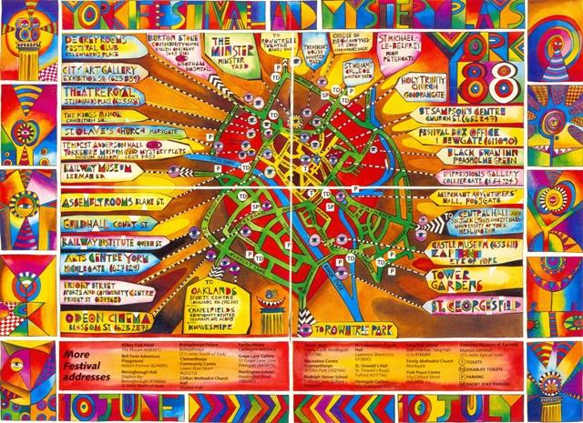
Below is a map from the centre pages of the 1988 Festival programme booklet. The colour illustrations are credited to Ken Meharg and the brochure design to Lyn Shields.

< Go back